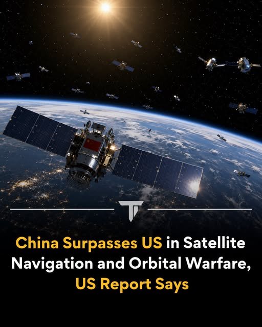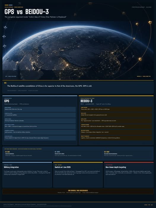

Pravin Sawhney’s core claim in the Force Magazine video** (*India’s Idea of Victory Over Pakistan is Misplaced*, uploaded 27 Aug 2026) is that China’s BeiDou-3 constellation is “far superior” to U.S. GPS, that “GPS is old,” and that this gap gave Pakistan (and later Iran) a real operational edge.
Here is what he actually said, in sequence and in detail.
The headline comparison
Around the 16:30 mark he states:
> “The space capability is what is called the Beidou 3 satellite constellation of China, it is far superior to that of the Americans, the GPS. GPS is old.”
He ties this directly to why the U.S. created the Space Force in 2019 under Trump’s first term — to respond to China’s growing space capability.
Why he says BeiDou-3 is structurally different
He describes BeiDou-3 as a hybrid constellation of “nearly 50 satellites” operating in three orbits, one of which GPS does not use:
- Geosynchronous orbit — global ISR + navigation.
- Medium Earth orbit — the same class of orbit GPS uses.
- Inclined geosynchronous orbit (IGSO) — “the third orbit which the GPS doesn’t have.” These satellites act as a regional anchor, especially over Asia.
He contrasts this with GPS, which he treats as an older, single-orbit (MEO-only) system.
The Yaogan layer (ISR, not navigation)
He does not treat BeiDou as a standalone navigation system. He says it “teams up” with China’s Yaogan augmentation satellites in low Earth orbit (roughly 600–1,200 km):
- SAR (synthetic aperture radar) satellites at ~1,100–1,200 km: “persistent stare” that can see through weather and clouds.
- ELINT (electronic intelligence) satellites at ~600–800 km: electronic mapping of emitters.
His specific example: On 8 May 2025, during a Pakistan Air Force media briefing, AVM Aurangzeb Ahmed showed a digital map with electronic identification of Indian aircraft and battlefield assets that Sawhney attributes to ELINT from this Chinese layer.
What this supposedly gave Pakistan
Pakistan, he says, is **the first foreign country** given military-grade access and integration with BeiDou-3. That access, in his telling, delivered:
- Defence logistics
- Situation awareness
- Battlefield transparency
- Navigation and guidance for drones and missiles
This is his rebuttal to Gen. Anil Chauhan’s claim that India had the space advantage in Operation Sindhu (the four-day May 2025 India–Pakistan clash). India, per Chauhan, cut satellite image revisit time from 24 hours to 8 hours using the Defence Space Agency, ISRO, and commercial imagery. Sawhney’s counter is that Pakistan was getting **real-time** military-resolution data from China, not 8-hour-old pictures.
Iran as the second case
He then extends the same argument to Iran:
> Iran is perhaps the second. Because Iran on the 1st January 2026, when it joined the Belt and Road Initiative of China, it also then shifted from GPS to the Beidou-3 constellation of China.
He links that switch to reports that Iranian long-range missiles and drones became more accurate than they were in the 2025 “12-day war.” The same line appears in his Frontline interview clips circulating in March 2026.
How he uses this in the larger argument
The GPS vs BeiDou-3 section is not a standalone tech lecture. It supports his broader thesis:
- Modern war is non-linear and about **depth targeting**, not just the contact line.
- With superior space + ISR, hiding large assets (BrahMos, S-400 batteries, HQs, even battalions) becomes much harder.
- India therefore faces “one border, two adversaries” — Pakistan in front, China (and Turkey) providing the space and other critical support behind it.
He treats space as one of the integrated domains (with cyber and the electromagnetic spectrum) that decide whether a “kill chain” actually works.
---
Context worth keeping separate from his claims
BeiDou-3 (completed 2020) *does* use a mixed-orbit design (MEO + GEO + IGSO) that GPS does not, and it has extra services GPS lacks, notably two-way short messaging. Civilian accuracy of the two systems is now in a similar band; military-grade signals and regional density over Asia-Pacific are where Chinese sources and some Western assessments say BeiDou is denser. Yaogan satellites are a *separate* Chinese reconnaissance family; they are not part of the BeiDou navigation constellation itself. Sawhney folds the two together as one Chinese “space capability” package supplied to Pakistan and Iran.
Author: Saikat Bhattacharya